|
epix
|
cfQue 1620
|
TracPak
|
Maps
|
Accessories
|
Buyer's Guide
| Shopping basket |
| GARMIN Montana 600/650/650t |
|
Our shop and our offices remain closed until September 20, 2026. |
|
All items are available while supply lasts. If you have questions, please use our contact form. |
Very rugged, portable, multi-functional GPS devices with extra large color display. Highly suitable as hand held devices and as navigation devices in vehicles. Fast change between different user interfaces and operation modes through adjustable profiles, shortcuts and dashboards. Rich feature set and very easy to use. Touch screen based user interface.
The devices of the GARMIN Montana 600/650/650t series are equipped with an integrated base map, an electronic compass, a barometrical altimeter, a slot for an uSD memory card, an USB connector plus connectors for external power supply and external GPS antenna. They adapt the display to the current orientation. Simply rotate the device to change from landscape to portrait mode and vice-a-versa. The Montanas support autorouting (optional map required) and wireless data exchange with compatible devices. These devices are suitable for outdoor activities (hiking, biking etc.) and thanks to their voice guidance also for navigation in vehicles (optional car mounting kit required for voice guidance). In addition, there is a marine mode for navigation on boats. They provide an easy to use touch screen and a graphical interface in various languages plus a very sensitive GPS antenna. There are various ways to configure the display. You may create shortcuts to applications and functions on three pages. There are also different dashboards with preset data fields to be placed on the application pages. The Montana devices are powered either by a rechargeable battery (included, lasts for up to 16 hours), three standard AA batteries (last for up to 22 hours) or by an external 12V source.
The Montana 600 and the Montana 650 provide 3.0 GB memory for user data and additional maps. The Montana 650t provides 7.35 GB memory, of which the pre-installed topographic map of Europe occupies about 4 GB leaving about 3.5 GB for user data and additional maps. The models Montana 650 and 650t are additionally equipped with a 5 megapixel built-in camera which automatically stores positional information about the images taken (geo tags).
Contents: Series - Features - Overview - Main Pages - Prices - Options - Downloads - Order
GARMIN Montana 600/650/650t series:
All models provide similar functions; these are the main differences:
 |
 |
 |
|
| Feature / Model | GARMIN Montana 600 | GARMIN Montana 650 | GARMIN Montana 650t |
|---|---|---|---|
| Built-in memory | 3.0 GB | 3.0 GB | 7.35 GB¹ |
| Camera | - | YES | YES |
| Pre-installed maps | Worldwide base map | Worldwide base map | Worldwide base map plus topographical recreational map of Europe |
| Price | discontinued | discontinued | discontinued |
¹) The pre-installed topographic map of Europe occupies nearly 4 GB of the available 7.35 GB, leaving about 3.5 GB for user data and other maps.
| To table of contents |
Features:
- Portable, easy to use, robust, waterproof to IPX-7 standard (withstands 30 minutes under water up to 1 meter (3 feet) deep)
- Very large, easy to read color display with background illumination (65536 colors, 272x480 pixel)
- Easy to use through the touch screen and user friendly, graphical interface
- Configurable display with shortcuts to applications and functions plus various dashboards
- Multilingual user interface in Bulgarian, Croatian, Czech, Danish, Dutch, English, Farsi (Persian), Finnish, French, German, Greek, Hungarian, Italian, Latvian, Norwegian, Polish, Portuguese, Romanian, Russian, Slovak, Slovenian, Spanish, Swedish and Turkish
- Voice guidance in Afrikaans (South Africa), Arabic, Bulgarian, Cantonese, Catalan, Croatian, Czech, Danish, Dutch, English (American, Australian, British), Estonian, French (European, Canadian), Finnish, Flemish, German, Greek, Hungarian, Italian, Japanese, Korean, Lithuanian, Luxembourgish, Mandarin (Chinese, Taiwanese), Norwegian, Polish, Portuguese (Brazilian, European), Romanian, Russian, Serbian, Slovak, Slovenian, Spanish (American, European), Swedish, Taiwanese and Turkish. These GPS devices have no built-in loudspeaker. In order to use voice guidance, an optional car mounting kit with an built-in speaker or an optional headphone is required.
- Integrated 12 channel GPS receiver with very sensitive built-in antenna
- Connector for external GPS antenna. Antenna and various cables available as options
- Integrated base map with countries of all continents including major cities
- Memory for user data and to transfer additional, more detailed maps with roads, crossings and addresses of restaurants, public buildings, points of interest etc. from a PC to the GPS: The models Montana 600 and Montana 650 provide 3.0 GB built-in memory. The model Montana 650t provides 7.35 GB built-in memory, of which the pre-installed topographic map of Europe occupies less than 4 GB, leaving about 3.5 GB free memory. All models are equipped with a slot for a standard micro SD memory card ("TransFlash"). Memory cards are available as an option.
- Electronic 3D compass to check heading while not moving¹, accuracy ±5°, resolution ±1°, can be turned off to safe power. "3D" means tilt-compensated compass which does not require the device to be level for accurate readings.
- Barometrical altimeter for precise elevation recording²
- Powered by rechargeable, replaceable battery (included), by 3 AA batteries or by an external 12 V power source, e.g. from a car's cigarette lighter (power cord available as an option). Rechargeable battery lasts about 16 h, batteries last about 22 h
- Short time to first fix (TTFF³: approx. 15 seconds after a warm start, meaning there are valid coordinates of the satellites available, or approx. 45 seconds after a cold start, meaning there are no valid coordinates of the satellites available)
- Supports the following protocols for data exchange with PC: GARMIN Spanner, GARMIN serial, NMEA-Input/Output, Text, RTCM
- Supports WAAS (improves accuracy of position indication from typical better than 15 m (49 feet) to typical better than 3 m (10 feet))
- Supports more than 100 different datum (coordinate systems)
- Supports various display formats include the Swiss Grid
- Firmware stored in Flash-Memory, can be updated by the user
- Operating temperatures -15 .. 70°C (5° .. 158°F)
- Highspeed USB interface, USB cable for data exchange with PC included
- Dimensions: 75x144x36 mm (2.9x5.7x1.4 inches)
- Weight: 290 g (10.2 ounces) with rechargeable battery, 333 g (11.7 ounces) with 3 batteries
- ¹) In order to check the heading with a GPS, a minimal movement with a speed of at least 5..8 km/h (3..5 mi/h) is required. Where no movement is not possible, a compass is needed.
- ²) Even though a GPS provides accurate elevation information, the value slightly varies continuously. A barometrical altimeter is therefore more accurate, especially when summarizing elevation changes.
- ³) TTFF: Time To First Fix, time until the first information about the current position is acquired.
Information for navigation:
- Stores up to 4000 waypoints with name (up to 30 characters), icon (choice of 75 symbols), note, coordinates, elevation and depth
- Stores up to 200 reversible routes.
- World map with zoom function in the range of 800 km to 5 m (500 mi to 20 ft)
- Information on the map displayed in 5 levels of details
- Support for ActiveRouting cartography - route calculation for various types of activities such as hiking or biking, requires an optional map which supports this feature, see www.garmin.com/de/topo/activerouting (in German).
- Support for LakeVu HD cartography - extrem detailed optional marine maps, see sites.garmin.com/lakevu.
- Find waypoints, favorites, cities and exits
- Extended search function for points of interest, addresses and intersections, if there is a MapSource map available in memory. These maps require a Windows PC plus a connection cable and are available as options, see MapSource.
- Bearing (electronic compass)
- Current position (longitude, latitude, altitude)
- Altitude via air pressure (barometer)
- Current accuracy of the position information
- Current time
- Current bearing
- Current, average and maximum speed
- Trip duration and distance (Odometer)
- Records the travelled path (track), capacity 10'000 track points
- Stores 200 travelled routes (tracks)
- Supports metric and U.S. units
Additional features:
- 5 MP camera, saves geo tags with pictures, see photo gallery (Montana 650/650t only)
- Air pressure trend (can take pressure readings every 15 minutes even while power is off)
- Calendar
- Alarm clock
- Stop watch
- Calculator
- Area calculation
- Time of sunrise and sunset, moonrise and moonset, current phase of the moon, constellation sun-earth-moon
- Information for hunters and fishers
- Heart rate, requires optional heart rate monitor
- Cadence of the crank arms, requires optional speed and cadence sensor
- Temperature, requires optional temperature sensor
- Support for optional VIRB action cameras, see also TrailTech and VIRB
| To table of contents |
GARMIN Montana 600/650/650t overview:

| To table of contents |
Main pages of the Montana 600/650/650t:
Note: The Montana 600/650/650t adapts the display to the current orientation of the device: It may show every page either in landscape or portrait format. You may lock the orientation if you prefer. Many of the pages are configurable, the pictures shown are just examples. For the data fields, there is a choice of 76 different values, see selection.
The two images below show the display of the Montana 600/650/650t in true resolution (272x480 pixels). This does not necessarily mean that the display is shown it its true size (51x89 mm). The actual size of these images depends on the properties of your display. All following images have been reduced to improve the appearance of this document.
| Main menu in landscape format | Main menu in portrait format |
 |
 |
|
|
| Applications 1 | Applications 2 | Applications 3 | Text Entry |
 |
 |
 |
 |
|
|
|
|
| Satellites | Elevation Plot | Trip Computer Small Font |
Trip Computer Large Font |
 |
 |
 |
 |
|
|
Switch between small font as shown above and large font as shown on the right. For each data field, you can choose from 76 different values1). |
Switch between large font as shown above and small font as shown on the left. For each data field, you can choose from 76 different values1). |
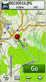
| Map (day mode) | Map (night mode) | ||
 |
 |
||
(This picture was taken with the optional map City Navigator Europe) |
|
||
| Direction | Auto Zoom | ||
 |
 |
||
(This picture was taken with the optional map City Navigator Europe) |
(This picture was taken with the optional map City Navigator Europe) |
||
| Route | Directions | ||
 |
 |
||
(This picture was taken with the optional map City Navigator Europe) |
(This picture was taken with the optional map City Navigator Europe) |
||
| Africa | Australia | China | USA |
 |
 |
 |
 |
|
|
|||
| Base Map (all models) |
Topographic Map of Europe (Montana 650t only) |
||
 |
 |
||
|
|
||
| Topographic Map of Europe (Montana 650t only) |
Topographic Map of Europe (Montana 650t only) |
||
 |
 |
||
|
|
||
| Topographic Map of Switzerland | |||
| Hittnau (vector view) |
Hittnau (pattern view) |
Schilthorn (vector view) |
Schilthorn (pattern view) |
 |
 |
 |
 |
|
|
|||
| Track | Waypoint Averaging | Calculator | Calendar |
 |
 |
 |
 |
|
|
|
|
| Alarm Clock | Stop Watch | Sun / Moon | Hunting / Fishing |
 |
 |
 |
 |
|
|
|
|
| Camera (Montana 650/650t only) |
Photo Viewer | Geotag | Heart Rate |
 |
 |
 |
 |
Photo gallery - these pictures were taken with an Montana 650t and give an impression of the performance of the integrated camera. |
|
|
(Trip Computer with large data fields and dashboard "Stop watch") |
Data fields selection:
- You can configure the device to show values in metric, english or nautic units.
- For each data field, you can choose one from the following 76 values.
- The values are grouped in 11 categories, the following categories exist:
- Time
- Speed and Distance
- Navigation
- Trip Data
- Elevation
- Aviation
- Current Status
- Stopwatch
- Heading
- On Road Navigation
- Other
| No | Category | Name | Explanation | ||||||||||
|---|---|---|---|---|---|---|---|---|---|---|---|---|---|
| A | B | C | D | E | F | G | H | I | J | K | |||
| 1 | X | 24hr Max Temperature | Maximum ambient temperature during the last 24 hours (requires optional temperature sensor) | ||||||||||
| 2 | X | 24hr Min Temperature | Minimum ambient temperature during the last 24 hours (requires optional temperature sensor) | ||||||||||
| 3 | X | Accuracy of GPS | The current accuracy of your GPS determined position | ||||||||||
| 4 | X | Alarm Timer | Current time of the countdown (set and start countdown on the alarm clock page) | ||||||||||
| 5 | X | X | Ambient Pressure | The uncalibrated current pressure | |||||||||
| 6 | X | X | Ascent Average | The average vertical distance of ascents | |||||||||
| 7 | X | X | Ascent Maximum | The maximum ascent rate | |||||||||
| 8 | X | X | Ascent Total | The total distance ascended | |||||||||
| 9 | X | Automotive Turn | Arrow symbol indicating the next turn | ||||||||||
| 10 | X | Average Lap | Average time for all completed laps | ||||||||||
| 11 | X | X | Barometer | The calibrated current pressure | |||||||||
| 12 | X | Battery Level | Battery charge level | ||||||||||
| 13 | X | X | Bearing | The compass direction from a position to a destination measured to the nearest degree; also called an azimuth. In a GPS receiver, bearing usually refers to the direction to a waypoint. | |||||||||
| 14 | X | Cadence | Revolutions of the crank arm per minute (requires optional bike speed and cadence sensor) | ||||||||||
| 15 | X | Compass Heading | Current heading based on the electronic compass | ||||||||||
| 16 | X | X | Course | The direction from the beginning landmark of a course to its destination (measured in degrees, radians, or mils) or the direction from a route waypoint to the next waypoint in the route segment | |||||||||
| 17 | X | Current Lap | Elapsed time of the current lap | ||||||||||
| 18 | X | X | Date | Current date | |||||||||
| 19 | X | Depth | Depth of water (requires NMEA input from a sonar device) | ||||||||||
| 20 | X | X | Descent Average | The average vertical distance of descents | |||||||||
| 21 | X | X | Descent Maximum | The maximum descent rate | |||||||||
| 22 | X | X | Descent Total | The total distance descended | |||||||||
| 23 | X | X | X | Distance to Destination | Current distance to the final destination | ||||||||
| 24 | X | X | Distance to Next | Current distance to the next waypoint or turn | |||||||||
| 25 | X | X | X | Elevation | Current altitude above sea level | ||||||||
| 26 | X | X | Elevation Maximum | Highest altitude above sea level since last reset | |||||||||
| 27 | X | X | Elevation Minimum | Lowest altitude above sea level since last reset | |||||||||
| 28 | X | X | X | Elevation Above Ground | Current elevation above ground (requires a map with sufficiant elevation data) | ||||||||
| 29 | X | X | X | ETA at Destination | Estimated arrival time at the final destination | ||||||||
| 30 | X | X | ETA at Next | Estimated arrival time at the next turn | |||||||||
| 31 | X | X | Glide Ratio | The ratio of horizontal distance travelled to vertical distance | |||||||||
| 32 | X | X | Glide Ratio to Destination | The glide ratio required to descend from your current position and elevation to the destination's elevation | |||||||||
| 33 | X | X | GPS Elevation | Current elevation based on GPS data | |||||||||
| 34 | X | GPS Heading | Current heading based on GPS data | ||||||||||
| 35 | X | GPS Signal Strength | Strength of satellites' signals | ||||||||||
| 36 | X | X | X | Grade | Current grade, computed based on distance and elevation gain or loss (must be moving) | ||||||||
| 37 | X | X | X | Heading | The direction in which you are currently moving | ||||||||
| 38 | X | Heart Rate | Current heart rate (heart beats per minute, requires optional heart rate monitor) | ||||||||||
| 39 | X | Lap Distance | Distance of the current lap | ||||||||||
| 40 | X | Laps | Number of completed laps | ||||||||||
| 41 | X | Last Lap | Elapsed time for the last completed lap | ||||||||||
| 42 | X | Location (lat/lon) | Current location as latitude/longitude coordinates | ||||||||||
| 43 | X | Location (selected) | Current location indicated in the selected format (datum) | ||||||||||
| 44 | X | Location of Destination | Coordinates of the final destination | ||||||||||
| 45 | X | None | Empty field | ||||||||||
| 46 | X | Odometer | Total distance travelled since last reset*) | ||||||||||
| 47 | X | X | Off Course | The distance you are off the desired course | |||||||||
| 48 | X | X | Pointer | Arrow that indicates the direction to travel to the next point on a route | |||||||||
| 49 | X | X | X | Speed | Current speed | ||||||||
| 50 | X | X | Speed - Maximum | Maximum speed since last reset*) | |||||||||
| 51 | X | X | Speed - Moving Avg. | Average speed without the time with no motion since the last reset*) | |||||||||
| 52 | X | X | Speed - Overall Avg. | Average speed including the time with no motion since the last reset*) | |||||||||
| 53 | X | X | Speed Limit | Current speed limit (requires a map which provides this information) | |||||||||
| 54 | X | Stopwatch Timer | Current stop watch time. Stops when stopwatch stopped. | ||||||||||
| 55 | X | Sunrise | Time of sunrise at the current position | ||||||||||
| 56 | X | Sunset | Time of sunset at the current position | ||||||||||
| 57 | X | Temperature | Current ambient temperature (requires optional temperature sensor) | ||||||||||
| 58 | X | Temperature - Water | Temperature of the water (requires an external data acquisition device) | ||||||||||
| 59 | X | X | X | Time of Day | Current time | ||||||||
| 60 | X | X | X | Time to Destination | Estimated travel time to the final destination | ||||||||
| 61 | X | X | Time to Next | Estimated travel time to the next waypoint (turn, crossing etc.) | |||||||||
| 62 | X | X | To Course | Direction to the planned course | |||||||||
| 63 | X | Total Lap | Elapsed time for all completed laps | ||||||||||
| 64 | X | Track Distance | Distance of the travelled track. Reset when the current track is cleared. | ||||||||||
| 65 | X | X | Trip Odometer | Travelled distance since last reset*) | |||||||||
| 66 | X | Trip Time - Moving | Time with motion since last reset*) | ||||||||||
| 67 | X | Trip Time - Stopped | Time without motion since last reset*) | ||||||||||
| 68 | X | Trip Time - Total | Total time since last reset*) | ||||||||||
| 69 | X | X | Turn | The direction of and the distance to the next turn on a route | |||||||||
| 70 | X | Velocity Made Good | The rate of closure to the destination, based upon your current speed and course | ||||||||||
| 71 | X | X | X | Vertical Distance to Destination | Elevation difference between current position and final destination | ||||||||
| 72 | X | X | X | Vertical Distance to Next | Elevation difference between current position and next turn | ||||||||
| 73 | X | X | X | X | Vertical Speed | Current ascending or descending speed | |||||||
| 74 | X | X | X | Vertical Speed to Destination | Required rate of ascent or descent to reach the final destination | ||||||||
| 75 | X | Waypoint at Destination | Name of the waypoint at the final destination | ||||||||||
| 76 | X | Waypoint at Next | Name of the next waypoint | ||||||||||
*) You may reset the trip-counters, the Odometer and the Maximum Speed separately.
| To table of contents |
Prices:
The models GARMIN Montana 600/650/650t have been discontinued; however, you can still order options for these devices.| To table of contents |
Options:
| Charger for rechargeable battery | CHF 30 | [Picture and details] | ||
| Rechargeable battery (one such battery comes with the Montana 600/650/650t) |
CHF 39 | [Picture and details] | ||
| Power/NMEA data cable with mini-USB connector and open ends | CHF 37 | [Picture and details] | ||
| USB cable for data exchange with PC (one such USB cable comes with the Montana 600/650/650t) |
CHF 12 | [Picture and details] | ||
| Mounting kit with suction cup including adhesive disk to be fixed on the dashboard (Does not include mounting bracket) |
CHF 16 | [Picture and details] | ||
| Dashboard discs | CHF 18 | [Picture and details] | ||
| Adhesive base for dashboard mounting kit to use it in a second vehicle (does not include mounting bracket) | CHF 12 | [Picture and details] | ||
| Removable base for GARMIN dashboard mounting kit (does not include mounting kit) | CHF 29 | [Picture and details] | ||
| Portable friction mount (new design; does not include unit mount) | CHF 29 | [Picture and details] | ||
| Handlebar mounting kit including screen protectors | CHF 35 | [Picture and details] | ||
| Motorcycle mounting bracket with power and audio cable including screen protectors (Mounting kit not included) |
CHF 66 | [Picture and details] | ||
| Long lanyard | CHF 5 | [Picture and details] | ||
| Retractable lanyard | CHF 30 | [Picture and details] | ||
| Screen protectors | CHF 15 | [Picture and details] | ||
| Chirp geocaching beacon | CHF 20 | [Picture and details] | ||
| Extension cable for external GPS antenna | CHF 37 | [Picture and details] | ||
| Adapter cable BNC to MCX for external GPS antenna | CHF 24 | [Picture and details] | ||
| Adapter cable MCX to BNC for external GPS antenna | CHF 33 | [Picture and details] | ||
| 4.0 GB micro SDHC memory card including µSD to SD adapter | CHF 9 | [Picture and details] | ||
| 8.0 GB micro SDHC memory card including µSD to SD adapter | CHF 16 | [Picture and details] | ||
| 16.0 GB micro SDHC memory card including µSD to SD adapter | CHF 19 | [Picture and details] | ||
| 32.0 GB micro SDHC memory card including µSD to SD adapter | CHF 21 | [Picture and details] |
All options for the GARMIN Montana 600/650/650t in detail.
MapSource, various µSD memory cards, DVDs and CDroms with topographic and street maps (products on DVD or CDrom require a computer and a cable for data exchange).
| To table of contents |
Downloads:
Here we provide additional documentation and software updates:
- Owner's manual (as PDF):
- Quick reference guide (as PDF):
- Firmware Upgrade V6.80 (Use WebUpdater to install this version)
- List of changes made with Firmware Upgrades
| If Adobe Acrobat Reader is not installed on your computer, you may download and install it for free. |
| To table of contents |
Order:
To order options for the GARMIN Montana 600/650/650t please:
- Click on the price or the shopping basket symbol
 to add the item you wish to purchase to the shopping basket. Your browser must accept cookies, otherwise the shopping basket won't work.
 - If the shopping basket does not work, please use this form.
Please read our terms and conditions.
| To table of contents |
Specifications and packaging of the products are subject to change without notice.
|
|
TRAMsoft GmbH Breitlenstrasse 8 / 8634 Hombrechtikon / Switzerland Contact Last modification: 07/16/2026 (RA) (This document was created with TRAMsoft XbCMS V1.3-00, does not require any browser specific features and is compliant with the W3C standard "HTML 4.01 Transitional") |
|